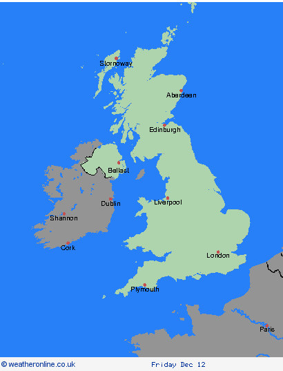
Weather Warnings Archive: Friday 12 Dec 2025 10:48 GMT - UK


00:00-06:00

06:00-12:00

12:00-18:00

18:00-24:00


Severe Weather Warnings: Rain
issued by the Metoffice at
10:48, 12.12.2025
valid from
12:00, 13.12.2025
until
12:00, 14.12.2025
Region: Highland & Eilean Siar
Rain will develop across western Scotland by late Saturday morning, becoming persistent and heavy at times through the day and into Sunday, before easing from the west late morning on Sunday. Most areas within the warning will see 30-50 mm of rain, whilst some of the high ground of Skye and western Scotland could see close to 100 mm. Strong and gusty southwesterly winds will accompany the rain. What Should I Do? Check if your property could be at risk of flooding. If so, consider preparing a flood plan and an emergency flood kit. Give yourself the best chance of avoiding delays by checking road conditions if driving, or bus and train timetables, amending your travel plans if necessary. People cope better with power cuts when they have prepared for them in advance. It’s easy to do; consider gathering torches and batteries, a mobile phone power pack and other essential items. Be prepared for weather warnings to change quickly: when a weather warning is issued, the Met Office recommends staying up to date with the weather forecast in your area.
Chief ForecasterPeriods of heavy rain may lead to travel disruption and some flooding
The public is advised to take extra care, further information and advice can be found here: http://www.metoffice.gov.uk/weather/uk/links.html
Severe Weather Warnings: Rain
issued by the Metoffice at
10:48, 12.12.2025
valid from
18:00, 13.12.2025
until
09:00, 15.12.2025
Region: Strathclyde
Outbreaks of rain will spread in from the northwest during Saturday afternoon and last through Sunday before finally clearing away on Monday morning. The rain will be persistent and heavy at times with accumulations 40-60 mm developing quite widely. Across high ground totals during this event could exceed 100 mm. Strong southwesterly winds are also possible at times. What Should I Do? Check if your property could be at risk of flooding. If so, consider preparing a flood plan and an emergency flood kit. Give yourself the best chance of avoiding delays by checking road conditions if driving, or bus and train timetables, amending your travel plans if necessary. People cope better with power cuts when they have prepared for them in advance. It’s easy to do; consider gathering torches and batteries, a mobile phone power pack and other essential items. Be prepared for weather warnings to change quickly: when a weather warning is issued, the Met Office recommends staying up to date with the weather forecast in your area.
Chief ForecasterHeavy and persistent rain may lead to flooding and travel disruption
The public is advised to take extra care, further information and advice can be found here: http://www.metoffice.gov.uk/weather/uk/links.html
Severe Weather Warnings: Rain
issued by the Metoffice at
10:48, 12.12.2025
valid from
12:00, 13.12.2025
until
12:00, 14.12.2025
Region: Strathclyde
Rain will develop across western Scotland by late Saturday morning, becoming persistent and heavy at times through the day and into Sunday, before easing from the west late morning on Sunday. Most areas within the warning will see 30-50 mm of rain, whilst some of the high ground of Skye and western Scotland could see close to 100 mm. Strong and gusty southwesterly winds will accompany the rain. What Should I Do? Check if your property could be at risk of flooding. If so, consider preparing a flood plan and an emergency flood kit. Give yourself the best chance of avoiding delays by checking road conditions if driving, or bus and train timetables, amending your travel plans if necessary. People cope better with power cuts when they have prepared for them in advance. It’s easy to do; consider gathering torches and batteries, a mobile phone power pack and other essential items. Be prepared for weather warnings to change quickly: when a weather warning is issued, the Met Office recommends staying up to date with the weather forecast in your area.
Chief ForecasterPeriods of heavy rain may lead to travel disruption and some flooding
The public is advised to take extra care, further information and advice can be found here: http://www.metoffice.gov.uk/weather/uk/links.html
Severe Weather Warnings: Rain
issued by the Metoffice at
10:48, 12.12.2025
valid from
18:00, 13.12.2025
until
09:00, 15.12.2025
Region: SW Scotland, Lothian Borders
Outbreaks of rain will spread in from the northwest during Saturday afternoon and last through Sunday before finally clearing away on Monday morning. The rain will be persistent and heavy at times with accumulations 40-60 mm developing quite widely. Across high ground totals during this event could exceed 100 mm. Strong southwesterly winds are also possible at times. What Should I Do? Check if your property could be at risk of flooding. If so, consider preparing a flood plan and an emergency flood kit. Give yourself the best chance of avoiding delays by checking road conditions if driving, or bus and train timetables, amending your travel plans if necessary. People cope better with power cuts when they have prepared for them in advance. It’s easy to do; consider gathering torches and batteries, a mobile phone power pack and other essential items. Be prepared for weather warnings to change quickly: when a weather warning is issued, the Met Office recommends staying up to date with the weather forecast in your area.
Chief ForecasterHeavy and persistent rain may lead to flooding and travel disruption
The public is advised to take extra care, further information and advice can be found here: http://www.metoffice.gov.uk/weather/uk/links.html
Severe Weather Warnings: Rain
issued by the Metoffice at
10:48, 12.12.2025
valid from
00:00, 14.12.2025
until
06:00, 15.12.2025
Region: Northern Ireland
Outbreaks of rain will affect Northern Ireland Sunday and clear away on Monday morning. The rain will be heavy and persistent at times with accumulations of 20-30 mm expected to develop widely. Over 50 mm could accumulate across higher ground. What Should I Do? Check if your property could be at risk of flooding. If so, consider preparing a flood plan and an emergency flood kit. Give yourself the best chance of avoiding delays by checking road conditions if driving, or bus and train timetables, amending your travel plans if necessary. People cope better with power cuts when they have prepared for them in advance. It’s easy to do; consider gathering torches and batteries, a mobile phone power pack and other essential items. Be prepared for weather warnings to change quickly: when a weather warning is issued, the Met Office recommends staying up to date with the weather forecast in your area.
Chief ForecasterPeriods of heavy rain may lead to travel disruption and some flooding
The public is advised to take extra care, further information and advice can be found here: http://www.metoffice.gov.uk/weather/uk/links.html
Severe Weather Warnings: Rain
issued by the Metoffice at
10:48, 12.12.2025
valid from
18:00, 14.12.2025
until
15:00, 15.12.2025
Region: Wales
Outbreaks of rain will move into the warning area during Sunday afternoon and clear away on Monday afternoon. The rain will be heavy and persistent at times with accumulations of 30-40 mm expected to develop widely. Over 100 mm could accumulate across higher ground. What Should I Do? Check if your property could be at risk of flooding. If so, consider preparing a flood plan and an emergency flood kit. Give yourself the best chance of avoiding delays by checking road conditions if driving, or bus and train timetables, amending your travel plans if necessary. People cope better with power cuts when they have prepared for them in advance. It’s easy to do; consider gathering torches and batteries, a mobile phone power pack and other essential items. Be prepared for weather warnings to change quickly: when a weather warning is issued, the Met Office recommends staying up to date with the weather forecast in your area.
Chief ForecasterPeriods of heavy rain may lead to travel disruption and some flooding
The public is advised to take extra care, further information and advice can be found here: http://www.metoffice.gov.uk/weather/uk/links.html
Severe Weather Warnings: Rain
issued by the Metoffice at
10:48, 12.12.2025
valid from
18:00, 13.12.2025
until
18:00, 15.12.2025
Region: North West England
Outbreaks of rain will spread in from the west during Saturday evening, persist through Sunday before eventually clearing away during Monday afternoon and evening. The rain will be heavy at times with accumulations of 50-70 mm developing quite widely across the warning area and over 100 mm across high ground. Totals will be highest across Cumbria, where over 200 mm could accumulate in places during this 48 hour period. Strong southwesterly winds are also possible at times. What Should I Do? Check if your property could be at risk of flooding. If so, consider preparing a flood plan and an emergency flood kit. Give yourself the best chance of avoiding delays by checking road conditions if driving, or bus and train timetables, amending your travel plans if necessary. People cope better with power cuts when they have prepared for them in advance. It’s easy to do; consider gathering torches and batteries, a mobile phone power pack and other essential items. Be prepared for weather warnings to change quickly: when a weather warning is issued, the Met Office recommends staying up to date with the weather forecast in your area.
Chief ForecasterPeriods of heavy rain may lead to travel disruption and some flooding
The public is advised to take extra care, further information and advice can be found here: http://www.metoffice.gov.uk/weather/uk/links.html
Severe Weather Warnings: Rain
issued by the Metoffice at
10:48, 12.12.2025
valid from
18:00, 13.12.2025
until
18:00, 15.12.2025
Region: North East England
Outbreaks of rain will spread in from the west during Saturday evening, persist through Sunday before eventually clearing away during Monday afternoon and evening. The rain will be heavy at times with accumulations of 50-70 mm developing quite widely across the warning area and over 100 mm across high ground. Totals will be highest across Cumbria, where over 200 mm could accumulate in places during this 48 hour period. Strong southwesterly winds are also possible at times. What Should I Do? Check if your property could be at risk of flooding. If so, consider preparing a flood plan and an emergency flood kit. Give yourself the best chance of avoiding delays by checking road conditions if driving, or bus and train timetables, amending your travel plans if necessary. People cope better with power cuts when they have prepared for them in advance. It’s easy to do; consider gathering torches and batteries, a mobile phone power pack and other essential items. Be prepared for weather warnings to change quickly: when a weather warning is issued, the Met Office recommends staying up to date with the weather forecast in your area.
Chief ForecasterPeriods of heavy rain may lead to travel disruption and some flooding
The public is advised to take extra care, further information and advice can be found here: http://www.metoffice.gov.uk/weather/uk/links.html
Severe Weather Warnings: Rain
issued by the Metoffice at
10:48, 12.12.2025
valid from
18:00, 13.12.2025
until
18:00, 15.12.2025
Region: Yorkshire & Humber
Outbreaks of rain will spread in from the west during Saturday evening, persist through Sunday before eventually clearing away during Monday afternoon and evening. The rain will be heavy at times with accumulations of 50-70 mm developing quite widely across the warning area and over 100 mm across high ground. Totals will be highest across Cumbria, where over 200 mm could accumulate in places during this 48 hour period. Strong southwesterly winds are also possible at times. What Should I Do? Check if your property could be at risk of flooding. If so, consider preparing a flood plan and an emergency flood kit. Give yourself the best chance of avoiding delays by checking road conditions if driving, or bus and train timetables, amending your travel plans if necessary. People cope better with power cuts when they have prepared for them in advance. It’s easy to do; consider gathering torches and batteries, a mobile phone power pack and other essential items. Be prepared for weather warnings to change quickly: when a weather warning is issued, the Met Office recommends staying up to date with the weather forecast in your area.
Chief ForecasterPeriods of heavy rain may lead to travel disruption and some flooding
The public is advised to take extra care, further information and advice can be found here: http://www.metoffice.gov.uk/weather/uk/links.html
Severe Weather Warnings: Rain
issued by the Metoffice at
10:48, 12.12.2025
valid from
18:00, 13.12.2025
until
18:00, 15.12.2025
Region: East Midlands
Outbreaks of rain will spread in from the west during Saturday evening, persist through Sunday before eventually clearing away during Monday afternoon and evening. The rain will be heavy at times with accumulations of 50-70 mm developing quite widely across the warning area and over 100 mm across high ground. Totals will be highest across Cumbria, where over 200 mm could accumulate in places during this 48 hour period. Strong southwesterly winds are also possible at times. What Should I Do? Check if your property could be at risk of flooding. If so, consider preparing a flood plan and an emergency flood kit. Give yourself the best chance of avoiding delays by checking road conditions if driving, or bus and train timetables, amending your travel plans if necessary. People cope better with power cuts when they have prepared for them in advance. It’s easy to do; consider gathering torches and batteries, a mobile phone power pack and other essential items. Be prepared for weather warnings to change quickly: when a weather warning is issued, the Met Office recommends staying up to date with the weather forecast in your area.
Chief ForecasterPeriods of heavy rain may lead to travel disruption and some flooding
The public is advised to take extra care, further information and advice can be found here: http://www.metoffice.gov.uk/weather/uk/links.html

12.12.2025