Weather Warnings Archive: Wednesday 17 Dec 2025 10:00 GMT - UK


00:00-06:00

06:00-12:00

12:00-18:00

18:00-24:00


Severe Weather Warnings: Fog
issued by the Metoffice at
10:00, 17.12.2025
valid from
00:00, 17.12.2025
until
10:00, 17.12.2025
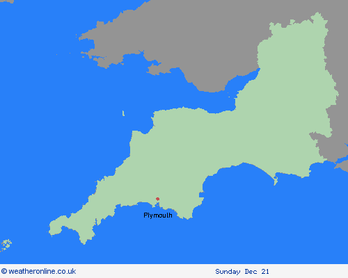
Region: South West England
Fog patches will affect parts of central and southeast England on Thursday morning. Some areas will not see fog, but where it does form it may be dense in places with visibility below 100 metres, leading to difficult travel conditions. Fog will slowly clear from the west after dawn but may linger until mid morning in the east of the warning area. What Should I Do? Give yourself the best chance of avoiding delays by checking road conditions if driving, leaving extra journey time, or amending plans if necessary. Make sure you know how to switch on your fog lights, and check they are working before setting off on your journey. Bus and train services, as well as flights may also be affected; check for updates from your travel company and follow their advice. Be prepared for weather warnings to change: when a weather warning is issued, the Met Office recommends staying up to date with the weather forecast in your area.
Chief ForecasterFog patches may lead to some travel disruption.
The public is advised to take extra care, further information and advice can be found here: http://www.metoffice.gov.uk/weather/uk/links.html
Severe Weather Warnings: Rain
issued by the Metoffice at
10:00, 17.12.2025
valid from
10:00, 17.12.2025
until
23:59, 17.12.2025
Region: South West England
A period of rain, heavy at times, especially over high ground, will move slowly east across this region during Wednesday. Coming off the back of recent very wet weather, some travel disruption and flooding is likely across much of the warning area. 10-20 mm of rain is likely to accumulate quite widely across the warning area, but 40-60 mm is possible over the high ground of Dartmoor and the hills of south Wales. Rain should clear to the east during Wednesday evening and into the early hours of Thursday. What Should I Do? Check if your property could be at risk of flooding. If so, consider preparing a flood plan and an emergency flood kit. Give yourself the best chance of avoiding delays by checking road conditions if driving, or bus and train timetables, amending your travel plans if necessary. People cope better with power cuts when they have prepared for them in advance. It’s easy to do; consider gathering torches and batteries, a mobile phone power pack and other essential items. Be prepared for weather warnings to change quickly: when a weather warning is issued, the Met Office recommends staying up to date with the weather forecast in your area.
Chief ForecasterHeavy rain could lead to some travel disruption and possible flooding.
The public is advised to take extra care, further information and advice can be found here: http://www.metoffice.gov.uk/weather/uk/links.html
Severe Weather Warnings: Rain
issued by the Metoffice at
10:00, 17.12.2025
valid from
00:00, 18.12.2025
until
21:00, 18.12.2025
Region: South West England
Some heavy rain will affect southern counties of England during Thursday, perhaps causing some disruption to travel, along the with the possibility of some flooding. Widely 15-25 mm is likely across the warning area, but 40-60 mm may fall in some places, most likely over the Downs. Rain will clear to the east by the end of the day. Strong winds, perhaps gusting in excess of 50 mph in some exposed coastal areas, will accompany the rain, perhaps exacerabating the impacts in a few places. What Should I Do? Check if your property could be at risk of flooding. If so, consider preparing a flood plan and an emergency flood kit. Give yourself the best chance of avoiding delays by checking road conditions if driving, or bus and train timetables, amending your travel plans if necessary. People cope better with power cuts when they have prepared for them in advance. It’s easy to do; consider gathering torches and batteries, a mobile phone power pack and other essential items. Be prepared for weather warnings to change quickly: when a weather warning is issued, the Met Office recommends staying up to date with the weather forecast in your area.
Chief ForecasterHeavy rain on Thursday may cause disruption to travel with some flooding possible.
The public is advised to take extra care, further information and advice can be found here: http://www.metoffice.gov.uk/weather/uk/links.html

